Laser scanning uses focused laser beams to capture millions of precise measurements of objects and environments, creating detailed 3D digital models. This technology measures distances by calculating light travel time, producing accurate point clouds that represent real-world surfaces. Industrial laser scanning enables precise documentation, quality control, and digital asset management across manufacturing and construction sectors.
What is laser scanning and how does it capture precise measurements?
Laser scanning, also known as laser scanning, captures measurements by emitting laser pulses and measuring the time it takes for the light to return after hitting a surface. The scanner rotates 360 degrees while emitting thousands of laser points per second, creating a dense point cloud of coordinate data. Each point contains precise X, Y, and Z coordinates along with intensity values that indicate surface reflectivity.
The technology works on the principle of time-of-flight measurement. When a laser pulse hits an object, it reflects back to the scanner’s sensor. The device calculates distance by measuring the travel time and applies trigonometry to determine exact spatial coordinates. Modern scanners can capture between 50,000 and over one million points per second, depending on the equipment specifications.
This process creates highly detailed digital representations of physical spaces and objects. The resulting point clouds serve as the foundation for creating 3D models, technical drawings, and digital twins that accurately represent real-world conditions.
How does laser scanning equipment actually work in industrial settings?
Industrial laser scanning equipment typically consists of a rotating laser unit mounted on a tripod or mobile platform. The scanner projects infrared laser beams while internal mirrors direct the beam in different directions. Advanced sensors capture the reflected light and convert timing data into precise distance measurements.
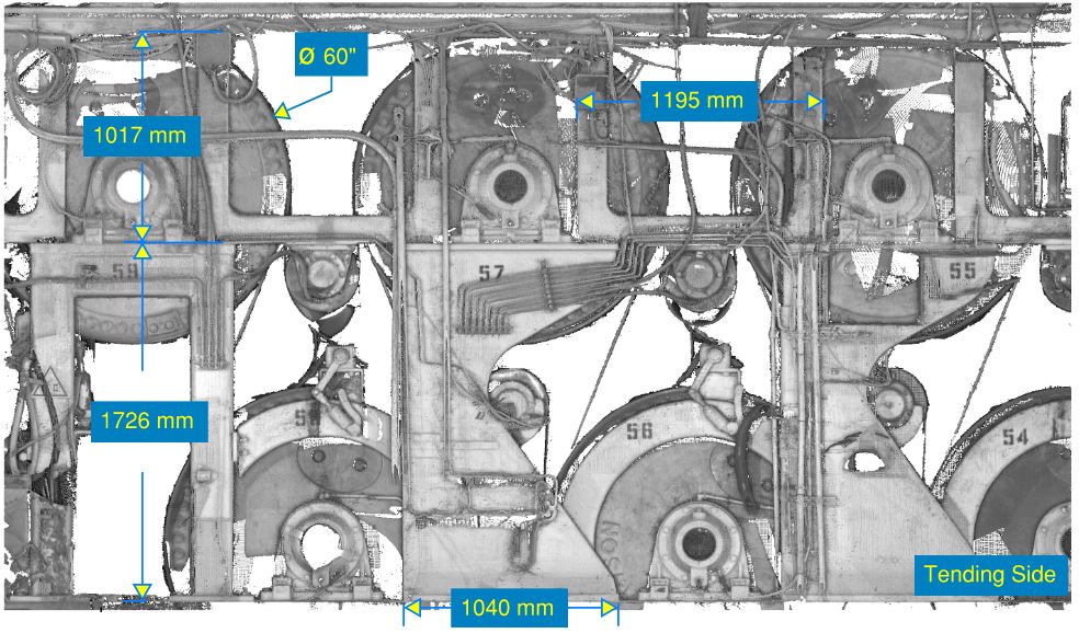
Industrial scanners often feature automated target recognition systems that identify reference points for accurate positioning. Many units include integrated cameras that capture colour information, allowing the point cloud data to be combined with photographic detail. This creates visually rich 3D models that are both geometrically accurate and photographically realistic.
The equipment connects to ruggedised tablets or computers that control scanning parameters and store data. Operators can adjust resolution settings, scan ranges, and point density based on project requirements. Battery systems typically provide 4–8 hours of continuous operation, while internal storage can handle multiple large datasets before requiring data transfer.
Modern industrial scanners also feature GPS integration for outdoor applications and can operate in challenging environmental conditions, including dust, moisture, and temperature extremes common in industrial facilities.
What are the main applications of laser scanning in industry today?
Construction industry laser scanning serves multiple critical functions, including as-built documentation, quality control inspections, and facility management. Manufacturing facilities use scanning for equipment alignment, pipe routing verification, and production line optimisation. The technology captures existing conditions before renovations or expansions, ensuring accurate planning data.
Construction projects rely on laser scanning for progress monitoring, clash detection, and dimensional verification. Contractors scan structures at various completion stages to compare actual construction against design specifications. This identifies deviations early, reducing costly rework and project delays.
Process industries use laser scanning for plant maintenance planning, shutdown preparation, and safety compliance documentation. The technology creates detailed records of equipment positioning, piping configurations, and access routes that support maintenance scheduling and emergency response planning.
Asset management applications include creating digital inventories of facilities, equipment, and infrastructure. These digital records support lifecycle planning, insurance documentation, and regulatory compliance requirements across various industrial sectors.
How accurate is laser scanning compared to traditional measurement methods?
Laser scanning achieves accuracy levels of 1–3 millimetres at ranges up to 100 metres, significantly outperforming traditional measurement methods. Conventional surveying with total stations typically achieves similar point accuracy but captures far fewer measurement points. Laser scanning and reality capture technology provides comprehensive coverage rather than selective measurements.
Traditional measurement methods require physical access to all measurement points, which can be dangerous or impossible in industrial environments. Laser scanning captures complete surface information from safe distances, including areas that are difficult or hazardous to reach manually.
The technology eliminates human measurement errors and provides consistent accuracy across entire scan areas. While individual measurements may have similar precision to traditional methods, the sheer volume of data points creates more reliable overall documentation. A single scan session captures millions of measurements that would take weeks to collect manually.
Speed represents another significant advantage. Laser scanning completes comprehensive site documentation in hours rather than the days or weeks required for traditional surveying methods. This rapid data collection minimises disruption to ongoing operations while providing more thorough documentation.
What should you consider when implementing laser scanning in your operations?
Successful implementation of laser scanning in investment projects requires careful planning of data requirements, processing workflows, and staff training needs. Consider the level of detail required for your applications, as higher-resolution scanning generates larger datasets that require more processing time and storage capacity.
Evaluate your existing software infrastructure and determine compatibility with point cloud data formats. Many organisations need to upgrade CAD software or implement specialised point cloud processing applications. Plan for adequate computing resources, as processing large scan datasets requires powerful workstations with substantial memory and graphics capabilities.
Staff training represents a crucial implementation factor. While modern scanners are user-friendly, operators need training in equipment operation, data quality assessment, and basic processing techniques. Consider whether to develop internal capabilities or partner with experienced scanning service providers.
Budget considerations include equipment costs, software licensing, training expenses, and ongoing maintenance requirements. Many organisations start with service providers to understand their needs before investing in equipment. This approach allows you to evaluate the technology’s value for your specific applications while building internal expertise.
Data management procedures are important for long-term success. Establish clear protocols for data storage, backup procedures, and access controls. Large point cloud datasets require significant storage space and organised file management systems to remain useful over time.
Laser scanning technology transforms how industrial organisations capture, analyse, and manage spatial information. The technology provides unprecedented accuracy and detail while reducing measurement time and improving worker safety. Whether you’re planning facility modifications, managing assets, or ensuring quality control, laser scanning delivers reliable data that supports better decision-making throughout your operations. We specialise in helping organisations implement these advanced measurement technologies to optimise their processes and achieve more accurate project outcomes. Get in touch for expert consultation.